
In the age of Google maps it may surprise many of you that paper maps are still around. In fact, as of late, paper maps have been making a huge comeback. Part of the reason seems to be nostalgia, but also the fact that you can print maps based on individual needs. Map vendors such as Stanford’s in London can print an individual map for customers based on their desired location and scale that suits their purpose. Unique maps can be printed for such purposes as hiking, biking or nature routes. This has all largely been made possible with the advent of GIS software and Open data allowing the creation of unique mapping tools.
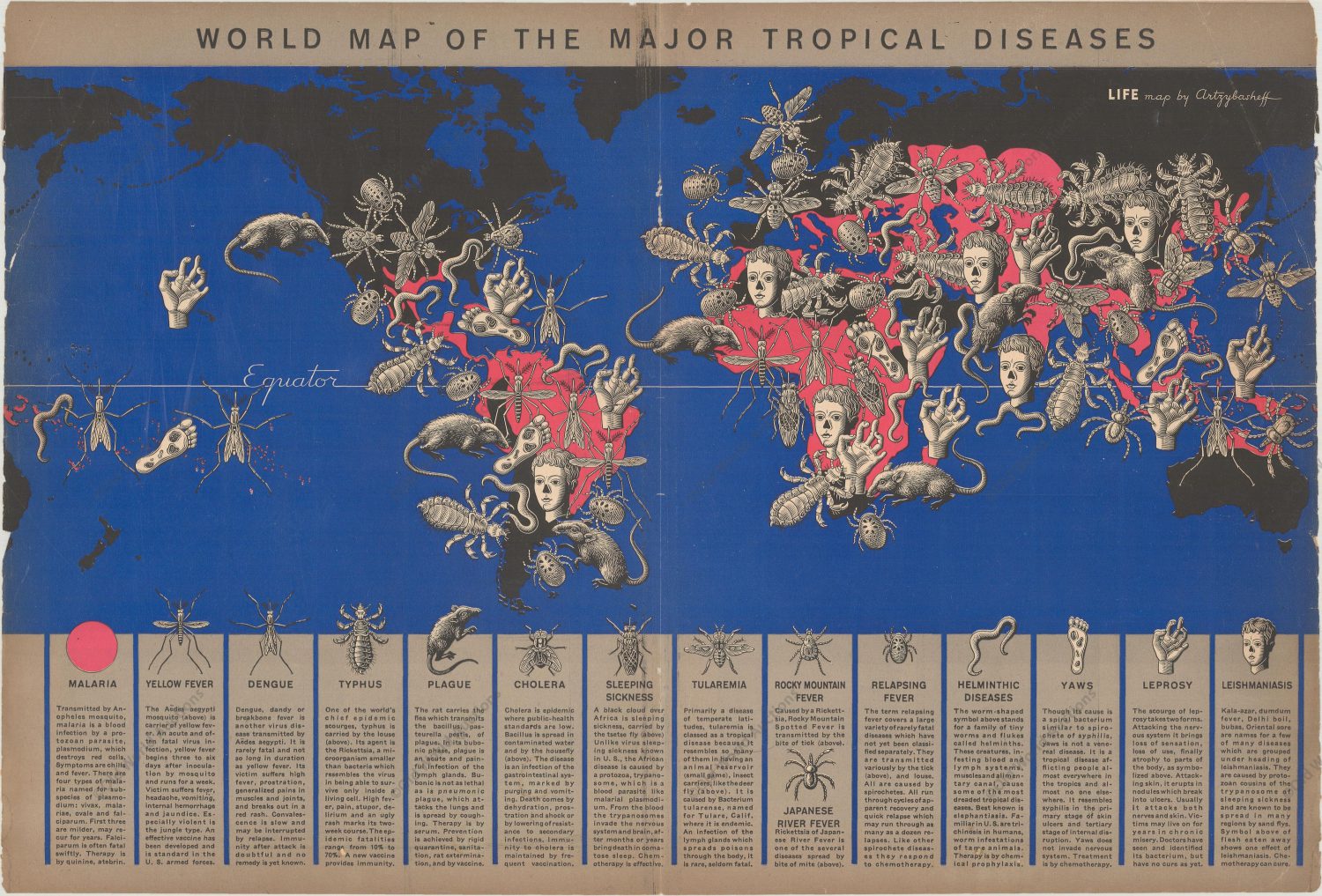
This new technology opens up a huge opportunity for your museum, your community, the local nature park or any other institution that wishes to promote itself and the surrounding area. GIS software and graphic design software can assist in the creation of thematic maps which are defined as “portraying a geographic pattern of a certain subject area”. There are many types of thematic maps: geologic, demographic, soils, climate public health, and the list goes on and on. Some of them truly are a work of art! Here is one of my favorites, it is a thematic map of the origin of tropical diseases created by Ukrainian cartographer Boris Artzybasheff (courtesy Leventhal Map & Education Center at the Boston Public Library):
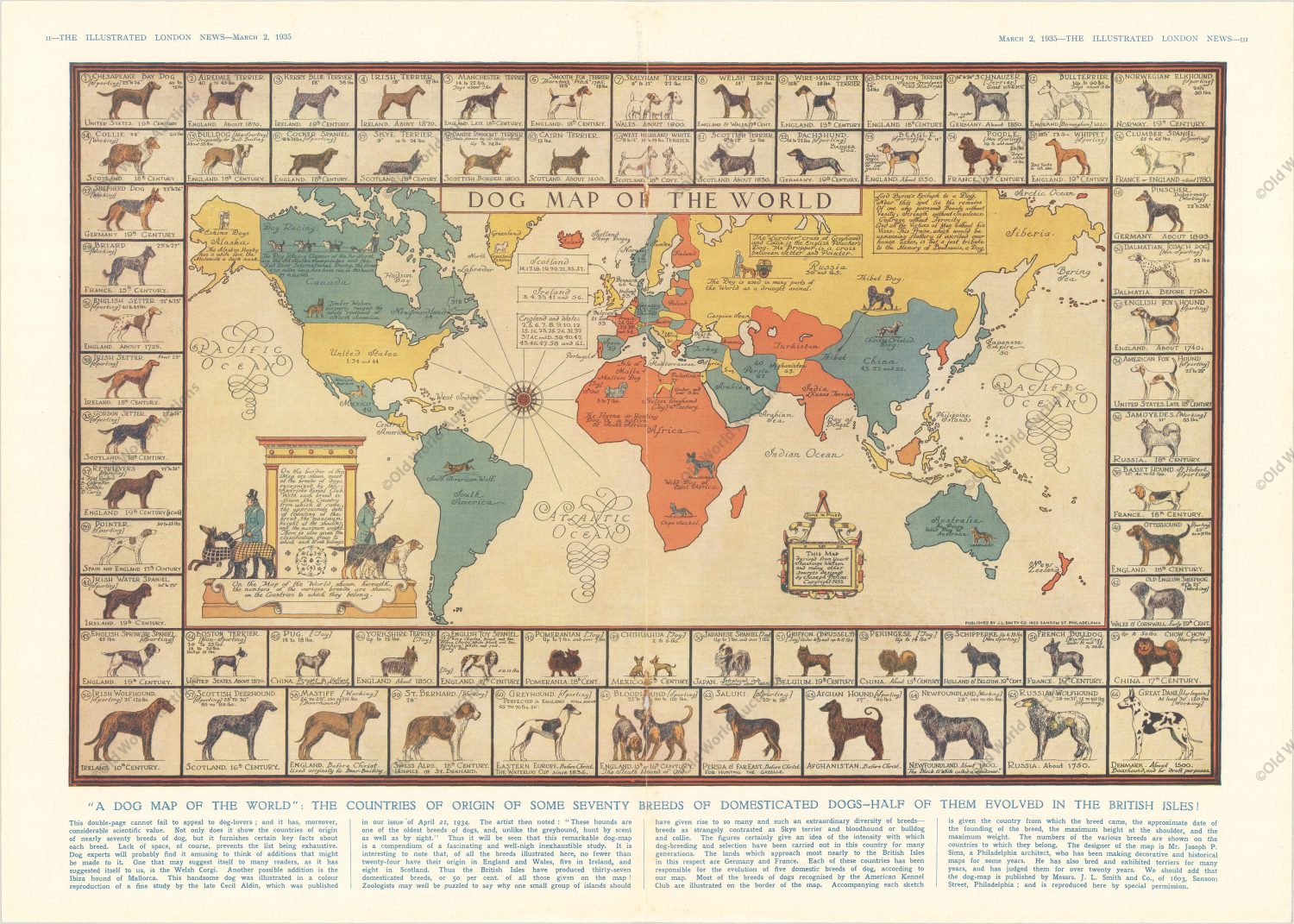
Here’s another one of my favorites that displays the geographic origins of 70 dog breeds (courtesy Leventhal Map & Education Center at the Boston Public Library):
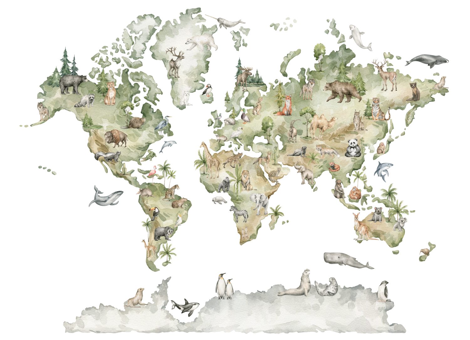
Of course, another of my favorites are the thematic maps of the animal kingdom, which I used to stare at for hours as a kid in school! Unfortunately, you don’t see many of these maps nowadays:
Here is another thematic map of Cleveland that got me thinking about local promotion for museums or any other local institutions (courtesy Leventhal Map & Education Center at the Boston Public Library):
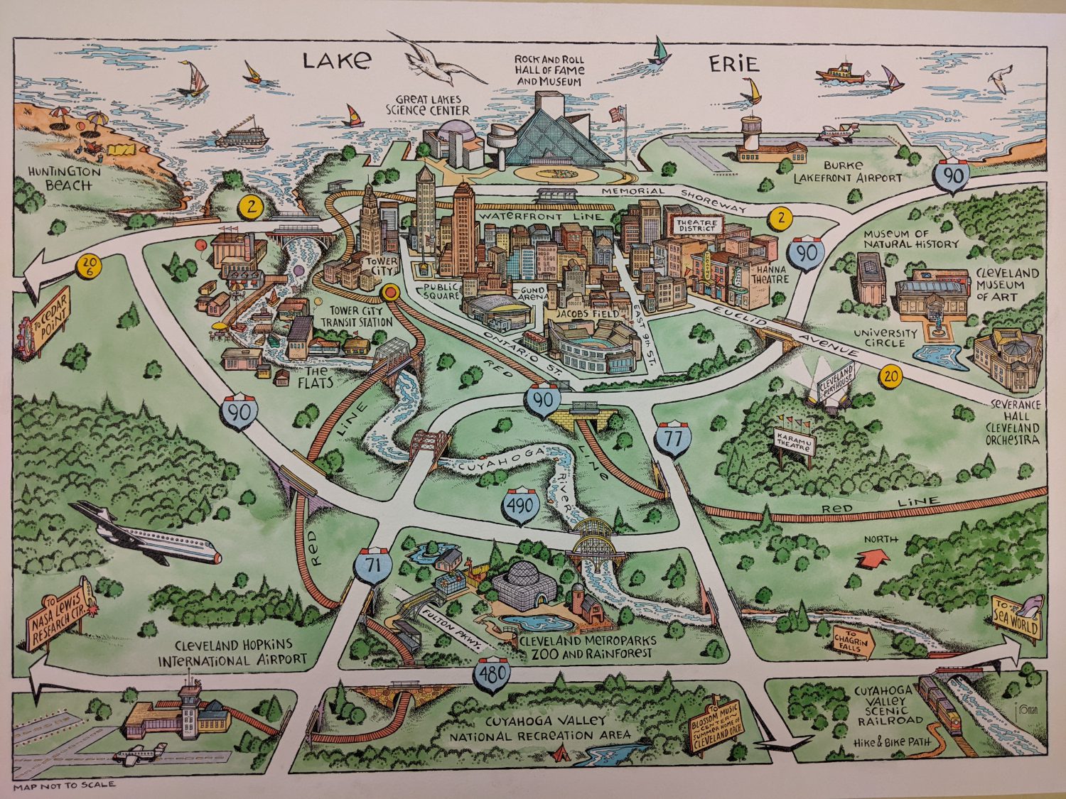
This is a stunning map from Cleveland that outlines not only the local points of interest (including the museum) but also the local flora and fauna of interest. What a wonderful way to promote your institution and also show the natural world that you are surrounded by! This could even be a small revenue stream for your institution if you wanted to sell them to your visitors. It would probably be more cost effective to join up with several other institutions in your community to cost share. There are many web-based services that could help you develop your local map. There is also the possibility of hiring a temporary GIS and Graphic design specialist through such services as Fiverr.com or Upwork.com. If you are brave you could learn to use GIS tools and do this on your own! For cheaper options there are open-source tools such as QGIS which has a wealth of “how to” tutorials free for use on YouTube. There have also been many excellent easy to understand and low cost QGIS manuals for purchase. The one that I would recommend for beginners recommend is here.
Start mapping and start promoting yourself in a new and unique way!!
Thank you for reading our Blog Post! This review was written with the assistance of “Grammarly”. Grammarly is an amazing FREE tool that allows anyone to write like a professional! For more information and a free download, click here.
For our Reviews of excellent books on Natural History, Archaeology and Technology, please visit our main website!